I am a masters student in the Sea and Society masters program at University of Gothenburg, Sweden, and I hold a masters in computer science. Due to my technical background, I was very interested in gaining more experience in GIS and remote sensing, which I was able to do on Intern Abroad HQ’s Aegean Marine Science & Island Conservation Internship. I decided to spend my summer in Greece to see what Archipelagos had to offer and how I could contribute!
The project I collaborated on for this internship is hugely important for the conservation of Posidonia Oceanica, an endemic plant of the Mediterranean Sea. Posidonia Oceanica is well known for the wide range of ecosystem services that are beneficial to humans.
Among other anthropogenic impacts, Posidonia Oceanica is threatened by the increasing number of leisure boats anchoring in rather shallow water (depth less than 40 meters), where the seagrass meadows are located. To avoid the damage of anchoring over Posidonia (which can contribute to unthinkable damage), the conservation team in Greece is working on installing permanent and ecological mooring systems in several target bays.
What were your internship activities focused on?
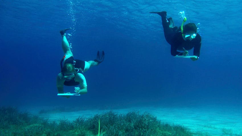
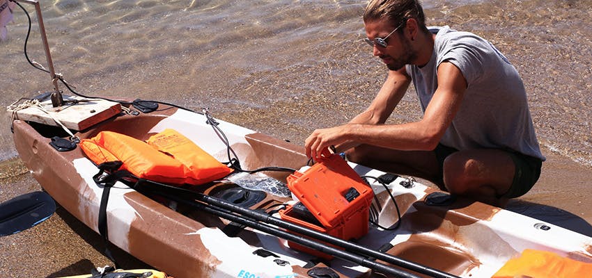
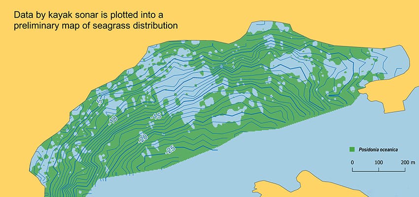
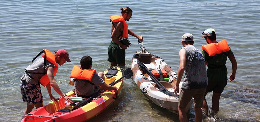
Our GIS internship task was to provide very detailed maps showing the distribution of Posidonia oceanica and the bathymetry in such bays. We spent our first weeks performing data collection on the field. We made use of kayaks equipped with sonar technology to detect seagrass presence/absence. Since we needed very high accuracy, we did not make use of satellite images as current resolutions are not good enough.
We opted on designing very dense transects for the kayak, with less than 20 meters space between the lines, and we ran interpolation methods on the processed sonar data to generate our distribution maps. QGIS was used for all these purposes. In order to obtain even more accurate maps, drone images can be used in combination with sonar data, by using image classification algorithms. Unfortunately, time limitations and a very windy summer forced us to postpone this idea!
How did these activities contribute to your professional development?
Our involvement with this project required moving the analysis of geographical and sonar data into Python, creating more efficiency by enabling us to process all data and generate maps by exclusively running our scripts. My contribution to this was to create a Python Notebook to automatically decode the sonar binary files and to generate plots showing the recorded bouncing data, which are used to detect Posidonia presence/absence.
The benefit of this is that these scripts can drastically reduce the time needed for processing data and remove any bias caused by personal interpretation, during manual data entry.
From a GIS team perspective, this internship in Greece provided me with the opportunity to contribute to a project in its entirety, from data collection and analysis to conclusions, with the possibility to use gear and equipment, such as the sonar, and with a well prepared supervisor.
How did this internship enable you to make an impact?
The Marine Institute of Conservation has trained scientists from countries of North Africa in this low cost and high-performance mapping technique. While every year it continues to train many young scientists from all over the world.
Without detailed maps showing the location of Posidonia meadows, it is impossible to enforce any protection, so the Archipelagos GIS team works hard to promote the enforcement of the existing legislation to protect our forests and seas, before it’s too late!
The forests of Posidonia are increasingly damaged by human activities such as the continuous and uncontrolled mooring, illegal fishing (outside fishing zones) with towed fishing gear (trawlers, seiners) and many more.
The effects are numerous and profoundly felt, so much in the productivity and the health of our seas as well as the erosion of beaches. When the rooting system of Posidonia ceases to exist, winter storms erode beaches and ultimately cause them to disappear.
Considering a Remote Internship instead?
If you’re not able to travel at the moment, this is a fantastic opportunity to complete your internship virtually from the comfort of your own home. A popular option is the Marine Ecology Remote Internship out of Greece where you’ll be working closely alongside our local team online while gaining valuable international experience and academic course credit.
Learn more about Intern Abroad HQ’s full range of abroad & remote marine biology internships here.
How can I get started?
Our step-by-step guide on how it works provides you with more information on how to get started. The process is user friendly and there are two options you can take to get the ball rolling.
-
If you’re unsure of which internship program is right for you, you can simply check availability to submit an enquiry which will help us to point you in the right direction. If you want to chat over the phone, you can also find our full contact information here.
-
If you already have an idea of what you want to do, and when you want to do it, you can submit your application. It doesn’t cost anything and won’t take more than 5 minutes. However, your formal expression of interest provides the foundation for us to help you take the next steps.